ME Section 4 Pictures - Milemarker 0.0 - 3.3
Monson - Blue-Blazed Trail to Pleasant St.
Move your mouse across the pictures for more information.

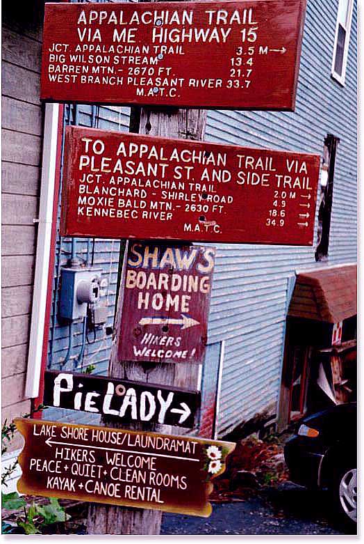
0.0 MM. Trail signs indicating distances to the AT from Monson. Also, lodging establishments in Monson. Pie Lady has closed down and Shaw's is under new ownership.
Submitted by askus3 @ optonline.net
mm 0.0 Sign as the trail goes southbound from ME 15
Submitted by dlcul @ conncoll.edu
Small clearing on the north side of Buck Hill. Taken at approx. mm 1.8
Submitted by dlcul @ conncoll.edu
mm 2.2 High point of the trail on the side of Buck Hill
Submitted by dlcul @ conncoll.edu
mm 3.3 A badly blue-blazed route follows this dirt road 0.2 - 0.3 miles to Pleasant Street which in turn can be followed 1.8 miles into Monson.
Submitted by dlcul @ conncoll.edu
mm 3.3 Parking area on Pleasant St. for the blue-blazed access trail to the AT. It is 0.2 - 0.3 miles to the AT.
Submitted by dlcul @ conncoll.edu
3.3 MM. Here is the trail sign at the parking lot and spur to the AT to the west of Monson on Bray Road (Pleasant Street). George Perkinson posing in this photo.
Submitted by askus3 @ optonline.net
mm 3.3 Trail sign at the junction of the AT and the blue-blazed access trail from Pleasant St.
Submitted by dlcul @ conncoll.edu