PA Section 8 Pictures - Milemarker 8.9 - 9.5
Powerlines - PA 225 (New Route)
Move your mouse across the pictures for more information.
The first seven pictures on this page were taken in 2010.
They show views from the current route of the trail between the powerlines (MM 8.9) and PA 225 (mm 9.5).
For some distance the trail follows an old ridge top road. Taken at approx. mm 9.1
Submitted by dlcul @ conncoll.edu
The southbound trail used to follow the old road all the way to PA 225. At this point it now bears left and continues as a footpath. Taken at approx. mm 9.1
Submitted by dlcul @ conncoll.edu
View along the northbound trail just before it regains the ridge crest and reaches the old road. Taken at approx. mm 9.1
Submitted by dlcul @ conncoll.edu
Looking to south from viewpoint at approx mm 9.1
Submitted by dlcul @ conncoll.edu
mm 9.3 View to southwest
Submitted by dlcul @ conncoll.edu
mm 9.3 View to south towards Dauphin Gap
Submitted by dlcul @ conncoll.edu
mm 9.5 Trail sign for northbound AT just as the trail leaves the parking lot on PA 225.
Submitted by dlcul @ conncoll.edu

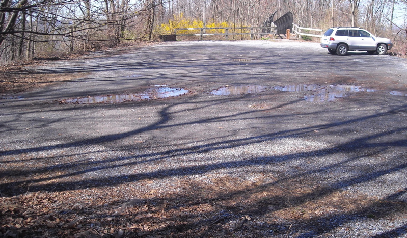
mm 9.5 View across the AT parking lot off PA 225 towards the
pedestrian bridge which hikers use to cross the highway.
Submitted by maltesecross @ comcast.net