TN/NC Section 17 Pictures - Milemarker 4.4 - 7.0
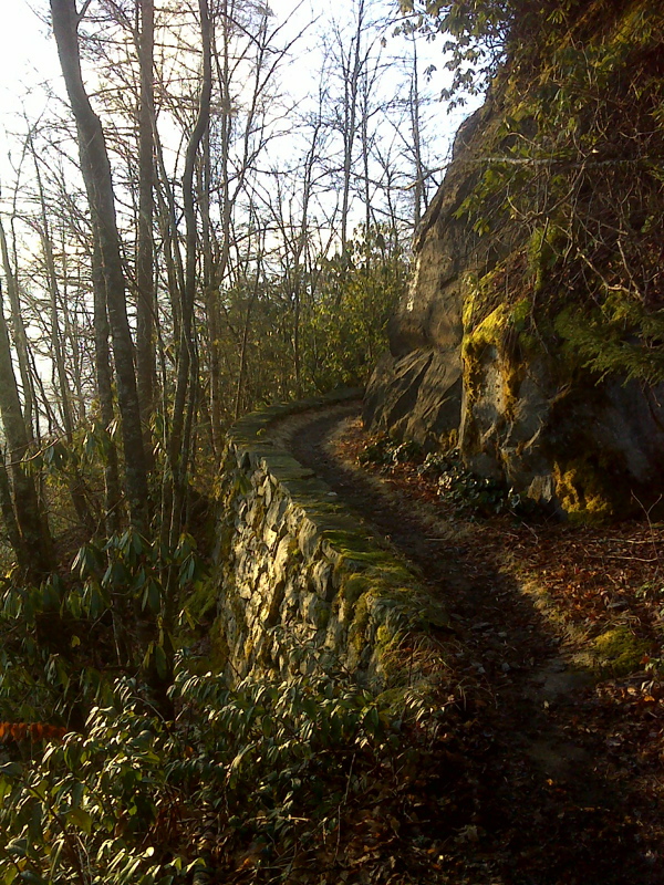
Trail Stonework - Trail North of Low Gap
Move your mouse across the pictures for more information.

mm 4.4 Superb CCC trail stonework. GPS N35.7624 W83.1578
Submitted by pjwetzel @ gmail.com
mm 4.4 Large Rock with views to the northeast behind it.
Submitted by dlcul @ conncoll.edu

mm 4.4 More than 100 miles of AT, Roan, Unaka, Max Patch, Snowbird. GPS N35.7621 W83.1576
Submitted by pjwetzel @ gmail.com
mm 5.2 Trail sign at intersection with the trail to Mt Cammerer firetower. From here the northbound trail starts the long descent to Davenport Gap.
Submitted by dlcul @ conncoll.edu
mm 5.2 The northbound AT approaches the trail junction with the trail to Mt. Cammerer Firetower. This goes straight ahead while the AT goes right.
Submitted by dlcul @ conncoll.edu
mm 5.4 The high point of the AT on the Mt. Cammerer ridge.
Submitted by dlcul @ conncoll.edu
mm 6.7 The AT crosses the crest of a ridge west of the summit of Rocky Face Mt.
Submitted by dlcul @ conncoll.edu
Partial view from trail. Taken at approx. mm 7.0.
Submitted by dlcul @ conncoll.edu