VA Section 21 Pictures - Milemarker 2.0 - 7.1
Bluff Mt. - Fullers Rocks
Move your mouse across the pictures for more information.
mm 2.0 - Summit of Bluff Mt. Note the concrete footings of old firetower that was once here.
Submitted by dlcul @ conncoll.edu
Some early fall color between summit of Bluff Mt. and Salt Log Gap
Submitted by dlcul @ conncoll.edu

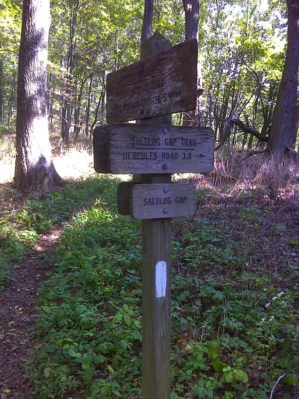
mm 3.5 Junction with the Saltlog Gap Trail in Saltlog Gap. This is not to be confused with Salt Log Gap further north in VA Sections 18/19. GPS N37.6540 W 79.3587
Submitted by pjwetzel @ gmail.com

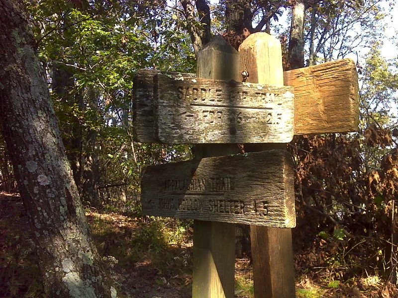
mm 4.6 Junction with the Saddle Gap Trail in Saddle Gap. GPS N37.6447 W 79.3728
Submitted by pjwetzel @ gmail.com
mm 6.0 - View to south from viewpoint just north of the summit of Rocky Row Mt. The long ridge across the valley in the picture is Thunder Ridge which the trail eventually traverses. One of the Peaks of Otter is in the background.
Submitted by dlcul @ conncoll.edu
View to the south from the steep south side of Rocky Row Mt. Taken at approx. MM 6.2
Submitted by dlcul @ conncoll.edu
mm 6.6 - View to the west from the point referred to in the guidebook as a "flat rock" on the steep south side of Rocky Row Mt.
Submitted by dlcul @ conncoll.edu
mm 7.1 - View of the James River from Fullers Rocks. The trail actually descends to the River, the lowest point on the Trail in VA/WV outside of Harpers Ferry.
Submitted by dlcul @ conncoll.edu